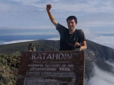
500 miles to go
No one could have predicted the enormity of the realization I came to today, not even me. What is this realization beyond comprehension? Well, I have less than 500 miles to go. To you, this may seem like a long way to go. However, to a hardened mountain warrior like myself who has walked almost 1,700 miles, it's not that far. Why does it have to end?
Some of my shelter residents decided to cause a big ruckus at 4:45AM this morning, which meant I was preparing for the day at 5:00AM. After Cookie was ready to go, we started walking north at 6:15AM.
Here's an interesting interaction I had with a person at the shelter last night:
Me: "Does anyone mind if I try to use my cell phone to call my Dad?"
Him: "I don't mind, as long as you use it like a privy?"
I'm still not exactly sure what he meant.
The steep climb out of the shelter was for no logical reason from my perspective. The only interesting thing about it was that it lead to a ridge with an interesting forest. It reminded me of Maine...
After meandering along a stream for a bit I cam upon the notorious Governor Clement Shelter. This is a popular spot for locals to come and harass hikers, particularly on weekends. Attention ATC, GMC, and USFS: The solution to the problem is to tear down the shelter(it's a piece of crap anyway) and post no camping signs. if your going to ban camping at what seems like all the cool camping spots, you had might as well ban it at the one that has a legitimate issue. Problem solved, thank you.
The climb up Killington was gradual to start and slowly deteriorated as I went further up the hill. There were a lot of spots that were thick in rocks and roots. There were several spots where I thought I was getting close to the top only to find more land mass around the next corner, other wise known as false summits. Eventually I did come across Cooper Lodge Shelter, which represents the end of the AT climb up Killington. In order to reach the actual summit, you must walk a death defying 2/10ths up the final hill, which Cookie and I decided to do. This side trail was very steep with a lot of rock faces that needed to be navigated .
The summit made it all worth it. I had a 360 view of the surrounding mountains of Appalachia. Once I found my bearings I looked in the direction of the White Mountains of New Hampshire. Let's do the deed.
After returning to the shelter, where I found a canister of gas and some GORP, we tumbled 4.4 miles to the Churchill Scott Shelter, where I ate lunch with Cookie. What you must understand is that I take pride in my lunch breaks, they are a key ingredient to my day. A day without a lunch break is like having no bread with peanut butter and jelly, it just doesn't make sense.
After descending to route 4 we walked 9/10ths of a mile to a land mark on the trail for northbounders: Maine Junction. This is where two storied paths split. The Long Trail continues to Canada, while the Appalachian Trail makes a sharp turn and heads towards Maine, hence "Maine" junction. That much closer to New Hampshire, which means the end of the death march through the hell known as Vermont. The finish line is within reach.
After ascending some viewless hill we descended down to VT route 100, where Gifford State Park is located. After finding out AT hikers receive a significant discount off regular camping fees, Cookie made the executive decision(which I affirmed) to stay for the night.
With less than 500 miles to go, I'm starting to heavily consider what I'll do once this trip is over. I'm considering finishing the Long Trail with Cookie, I also told my Grandma I'd help her around her house for a week. I also plan to bike with a friend to Sugarloaf Mountain Ski Resort at the end of August. Sounds like my summer is booked solid.
Tomorrow I'm mentally prepared to go 28.3 miles, but we shall see how the day progresses.
And that's the way it was.
Kirby
Ga>ME 2008.


