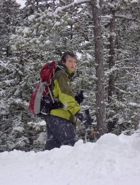
My 2008 Appalachian Thru Hike Journal

Stories from five months of backpacking from Georgia to Maine

Summary

Georgia
Mar 1st to Mar 9th, 2008 Calculating... miles
Mar 9th, 2008
16 miles
Mar 8th, 2008
0 miles
Mar 7th, 2008
9.4 miles
Mar 6th, 2008
10.6 miles
Mar 5th, 2008
4 miles
Mar 4th, 2008
7 miles
Mar 3rd, 2008
13 miles
Mar 2nd, 2008
5 miles
Mar 1st, 2008
2 miles
Pre-trail
Sep 29th to Feb 29th, 2008 Calculating... miles
Feb 29th, 2008
miles
Jan 11th, 2008
miles
Nov 19th, 2007
miles
Oct 7th, 2007
miles
Oct 2nd, 2007
miles
Sep 29th, 2007
miles
North Carolina
Mar 10th to Mar 11th, 2008 Calculating... miles
Mar 11th, 2008
12.5 miles
Mar 10th, 2008
12 miles
Tennessee
Mar 31st to Mar 31st, 2008 Calculating... miles
Mar 31st, 2008
16.7 miles
Total distance: Calculating...
Pre-trail

100 days to go

Total distance: Calculating...

The full weight about my Appalachian Trail thru hike is starting to set it. I officially have less than 100 days until I leave to meet my group. In 99 days, there will be no more planning. In 99 days, there will be no turning back.

It is hard to believe there is less than 100 days to go. I feel like I have a lot of things to get done, many tasks lay unfinished, when that really is not true. My planning is almost complete, I am working on mail drops right now, but that is the last major planning hurdle.

It is hard to believe, still, as I sit here, wow! I am going to attempt to hike from Georgia to Maine, that is an awfully long way, but doable. I look forward to standing in the parking lot at Amicalola Falls State Park, I look forward to be standing at the top of Springer Mountain, I am ready, and yet I have this odd feeling of not being ready, as if something is missing, when really it is me really starting to comprehend what I want to do. With only 99 days to go, butterflies are starting to form in my stomach, I am preparing to enter the unknown. How far will I make it? I have absolutely no idea. I now start my contemplation, of the unknown. KirbyGA>ME 2008

Total distance: Calculating...
Pre-trail

Nothing Cooler Than Hiking

Total distance: Calculating...

Well, this past weekend I hiked the Bigelow range right here in good old Maine. Originally, my friends Joel and Nate were going to hike it, but then Nate realized he could not go, so I was invited. Now, on a little side note. Nate and I had a argument about this. he argued that playing in two soccer games, playing frisbee, training for the states in cross country, and volunteering at the Maine Marathon, was cooler than hiking the Bigelow range. let the record reflect that nothing is cooler than hiking, NOTHING.

Now that we have clarified that issue, onto my little adventure. We(Joel and myself), started out at 7:15 on the Appalachian Trail VIA route 17. The first couple of miles were nice, not all that difficult. The climb up to Horns Pond was steep with a lot of rocks, certainly made this young man sweat(?) his sorry ass up the mountain. Horns Pond was nice, met a nice ridge runner who was well informed except for that fact that he lied to us about water. He said the water source at the pond was dry but that there was a alternate water source .3 miles down the trail, well, he was wrong, and we were angry. We thought we were going to climb both the South and North Horn. Well, as the trail up the South Horn was walking all over us, we decided we were not walking 10 feet off the trail to touch another summit, we were flustered, sweating endlessly, tire, hungry and thirsty, typical day on the good old AT. Summit of South Horn was nice, met a couple of section hikers out for the weekend, they have been at it for 11 years and anticipate to complete the entire trail by the following July. One of them said something to me that has stuck with me. As we were looking out towards West Peak, it looked like a long way. He said "looks like 30, feels like 5, its actually 2." I was close to adopting the trail name 30-5-2, but I am not sure if I want numbers for a trail name, I will get back to all you loyal readers sometime in the future. Meanwhile we continued our push to West Peak. It was steep, rocky, and steep. What a summit! Well worth the effort, did not have a perfect day, but we still ha nice views! We had out summit photo taken, once I find my camera cord, I will put those photos on this site. We then continued on to Avery Peak, nice peak as well, old fire shack up there, not open to the public, bordered up with wood. On our way back, we ran into someone. This man's name in Steven Rowe, and currently this man is the Attorney General of the great State of Maine. We talked for a little while. I confirmed he is running for Governor in 2010, he has my vote. It really is odd who you see out hiking, great guy too, very respectful, puts Alberto Gonzales to shame, but Gonzales did that to himself, Rowe just put the nail in the coffin. Meanwhile, before we went to Avery Peak, we decided to leave our packs at the Avery Memorial campsite because we were going to come back and head down the fire wardens trail. Well, the Attorney General informed us some varmint were getting into a pack left behind. When we returned to the campsite, this stupid red squirrel was getting into another hikers back, he too left his pack behind before heading to the peak. I have no mercy for these stupid little things. I started battle with the thing the moment I returned to the campsite. It was persistent, but Joel and myself fought that thing off until the hiker returned. Again, I have no mercy for these things, and I was aggressive in my pursuit against the thing. I have referred the case to the Attorney General for further investigation. Now, the descent down the fire warden's trail, the great person who created this fine piece of work. Very steep to start, lots of staircases, which was nice. Then it started to level out, but it just kept on going, and going, and going, and going. nothing to look at, nothing to keep me occupied. Those were the long 3.7 miles I have ever hiked. It never ended, miserable, we were tired. I was ready to call the National Guard and demand my tax dollars be put to work and have a helicopter come get us. So, that was out adventure through the Bigelows, had a great time, look forward to returning there next summer during my thru hike. Until then, Kirby30-5-2????

Ga>ME 2008

Total distance: Calculating...
Pre-trail

Preparing in the 100 Mile Wilderness

Total distance: Calculating...
Preparing in the 100 Mile Wilderness

well, I have received many questions about my little adventure in the 100 mile wilderness this summer, so, instead of answering the same question many different times, and in many different ways, I am going to write it here, seeing as this is my Appalachian Trail journal after all.

Starting weight:43 pounds My journey in the 100 town free zone, formerly known as the 100 mile "wilderness"/

Day One, Started in Monson, finished at the Long Pond Stream lean-to, distance was 15 miles. This was the worst 15 miles of the whole trip. The profile map makes the trail look relatively easy, with some small ups and downs. Well, these 15 miles never ended! they just went on and on to the point where I was ready to call the MATC and demand a helicopter lift out of there. There was nothing really to look at either, one cool waterfall, and that is about it.

Day two, started at the Long Pond Stream lean-to, finished at East Chairback Pond, distance was about 13 miles. The chairback range was really nice at times, and really frustrating at others. Barren mountain had a great view, well worth the climb at 7am(who had the brillant idea to put a shelter at the base of a long climb?)Ohh well, just another complaint for the great people of the MATC. the first mile out of camp was poorly maintained too, the only thing that kept me on the trail were the white blazes, and those were few and far between. The rest of the trail was typical Maine trail, enough rocks and roots to supply everyone in the United States with a gift and the trail would still have plenty of them. The rocks were also slippery because rain had been in the area a couple of nights earlier(what a storm that was, I was tucked away at Shaw's for that).I did not bother to look at the barren slide. The campsite was nice, I saw a moose there, not an official campsite, but people clearly camp there.

Day three, started at East Chairback Pond, finished at East Branch Lean-to, distance of roughly 18-19 miles. What a day! The whole day was the best I had had thus far in the "wilderness"! The trail was spectacular, not all that difficult. Gulf Hagus was nice, the part I saw of it, it was really interesting walking through the hermitage as well, I now have a lot of respect for those wise old trees. However, the climb up Gulf Hagus mountain and West Peak were quite difficult, very steep, a lot of rocks and an endless amount of roots. White Cap was spectacular, class 1 day easily, I could clearly see Katahdin off in the distance, was a view that is. I could have sat there all day staring out at everything I could see, just amazing. Nice weather overall, where is this yellow brick road though? I thought the Appalachian Trail was supposed to be a "Walk In The Woods"? Maybe Bryson was not paying close enough attention. At east bran lean-to I met my friend Robo, who has hiked 4,000 miles in his life, I ended up hiking with him for the remainder of my trip, great guy to have around.

Day four, east branch lean-to to Potawadjo Spring lean-to, distance of roughly 18-20 miles. Flat. Flat. Flat. The trail was really nice, not too many rocks and roots, realatively flat, just a really nice day on the trail, great weather as well. Robo and I trucked our way 18 miles to this shelter which was nice, way to many mice though. That's another thing, the varmants in the 100 mile "wilderness" were horrible. I am a humane person, but i was at the point where I was showing no mercy to these stupid little creatures. They have no fear of humans anymore, I also had a cup of coffee with Robo, so I was up all night fighting these bastards, he was amused, I was angered, I did see the humor in it in the morning though. Nothing much about this day though, had a great time on the trail. Up to this point I met a lot of great people, several thru hikers, and several section hikers. I also talked to my dad for the first time during my trip today, that was nice, he was getting a little worried, but i eased his tensions. You don't know what you've got till it's gone.

Day five, east potawadjo spring lean to to rainbow springs lean to, distance of 20 miles, roughly. Tough 20 miles, I was caught in a small lightening storm on Nesuntabunt, Robo shrugged it off and kept moving, I insisted on going into lightening position while the storm passed. Again, really tough day, the trail was very tough on my legs. At one point it took us a hour and change to cover a mile, when we normal cover 2-2.5 miles an hour. There was nothing special about this section, except for the fact that it was very long and drawn out, slept like an angel when we got to the shelter. Robo helped me kill some of my extra food, I had too much for the section.

Day six, completion of the 100 mile "wilderness", rainbow springs lean to to Abol Pines campsite, distance of 15 miles. We made it out of the "wilderness" today, passed the famous sign they have up for southbounders, but they do not have one at the other end for NOBOders? Hmm, guess us NOBO's are just amazing like that. Nice ridge walking at the rainbow ledges. Rainbow mountain, if they really wanted hikers to climb this mountain, the trail would re routed to go over this thing, I am not walking my sorry ass 1 mile to climb another mountain on a day with no views just to retrace that one mile and go climb some more mountains that are on the actual trail. No view from Abol Bridge when we arrived, there was a spectacular one later that evening. Katahdin really is a special mountain. What a place to end a 2,000 mile journey, or if your name is Kirby, a 125 mile journey. I met a ridegerunner I know at the store at Abol Campground, it is really odd the places you meet people know. Another ridge runner I met in the "wilderness" gave away i was coming. It really si amazing how much more fellow hikers are interested in hearing your stories than average joe Americans, I guess they understand what you are saying and what you are going through. The state campsite there is really nice, right on the Penobscott river, met some cool people though, Robo seems to be able to start a conversation with everyone, no matter who they are. I suppose you get that skill after 4,000 miles, I prefer to mind my own business. To Katahdin.

Day seven I hiked to Katahdin Stream Campground VIA the Blueberry ledges trail, nothing special, felt no need to hike the AT in the park, I wanted to have a short day. Nice trail, poorly maintained, very difficult to follow.

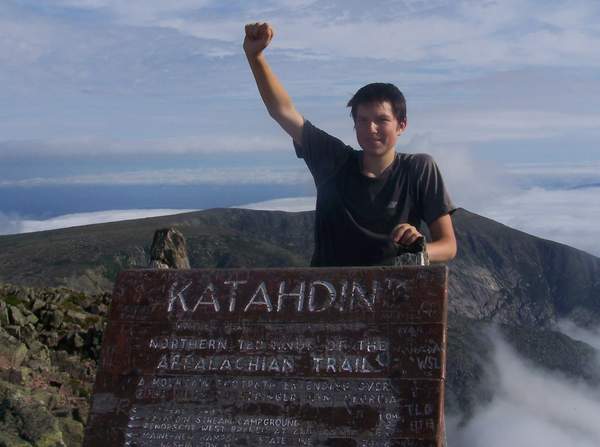
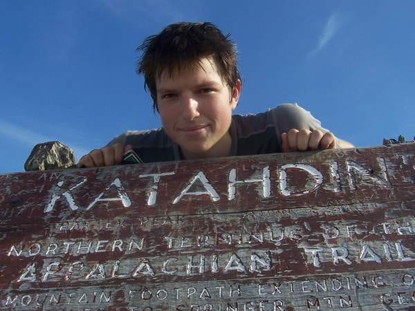
Day eight, Mount Katahdin via the Appalachian Trail. What a day, a lot of boulder scrambles, lots and lots of boulder scrambles. 4 and half hours up, roughly the same going down. What a way to end the journey, it was nice being able to look back at what I had just covered, and beyond. Lots of people on the summit. Robo, myself, thru hikers Knify Spoony, Yardsale, Waffle, and Yorkie, all started in Georgia. Words really can not describe what i felt when I got there, I was upset I was not going to wake up the next morning and hike. the next day I was going to have to hang around in Millinockett as all my friends left for their journeys home. I had mixed feelings. I was proud I completed my first major long distance backpacking trip, while upset it was all over.

That was my journey through the 100 mile "wilderness". I had a great time, and i do look forward to my 2008 GAME hike on the Appalachian Trail. I am looking forward to the people I meet and the places I see. What a trip,Kirby

Ga>ME 2008

Total distance: Calculating...
Pre-trail

Georgia to Maine 2008

Total distance: Calculating...

I guess I should tell you a little about myself so you, the reader, can better understand the journey I am about to undertake, because if the reader is not happy, the world will crumble and I will be shunned from the hiking community at the ripe age of 16(wow I told you something about myself without even meaning to, I deserve a gold star for that one). Indeed, the newspapers are correct, I am going to hike the Entire Appalachian Trail, Springer To Katahdin for those of you in the know, Georgia to Maine for those of you who have no idea what I am talking about, at the ripe age of 16, to give myself a little credit I will be 17 two weeks into the trip.

So, I guess this is the part where you wonder how the hell does a 16 year drop everything, including school, and go backpacking for 6 months? Well, I am glad you asked(even if you did not, you are going to read the explanation I am about to give). Thanks to the fantastic High School I go to, Casco Bay High School in Portland, Maine, and to a even greater principal, Mr.Pierce, and a great former Superintendent, Mary J O'Connor, I have managed to make it work. I will be doing all missed work ahead of time, which I have already started. Any work that I do not manage to complete, which would not be that much, will be completed in the first few weeks of my trip. I will be reading six books along the trail, 3 of my choice, 3 of my school's choice, we came to these numbers after long negotiations in which I went on strike to receive concessions from the school. I will also be keeping a journal as part of the strike negotiations, which as you can see, has already started. Any more questions about this topic can be forwarded to my PR person at Kevin Kirby and Sons, which does not exist for those of you who would even consider trying to get more information.

Now that the boring information is out of the way, I should tell you why the hell I want to bitch and moan my way 2,000 miles over mountains, through rain, sleet and even snow(and a little sunshine)from Georgia to Maine. You see, I could give the simple answer of 'because it is there', but I get the funny feeling that would not satisfy you, so below you will find my actual reasoning, I have marked the start and the end of the story with stars for those of you who wish to make this brief and move on.

*I was on an Outward Bound Backpacking course in the summer of 2006, we had just left the summit of Old Speck(we got there VIA the Grafton Loop Trail), and left VIA this trail marked with these white rectangular things known as blazes. Being the person I am, I naturally asked my instructors what trail we were on, I should have seen this answer coming. Being the instructors they were they told me to take out our map and look at it for the name of the trail(bear in mind all of this happened in about 5 minutes). So, I asked the navigator for the day if I could look at the maps to find the trail. After a little bitching and moaning about how he/she did not want to take off her pack and look for the maps(it turned out to be in the top pocket, easily accessible). When we looked at the map, there was no trail name, just a symbol(the symbol for the Appalachian Trail for those of you who have any idea of what I am talking about). So, I kept walking down this unknown trail and eventually came to a tree that had a piece of metal on it(the old AT markers for those of you in the know) that had the symbol that I saw on the map. I looked at the maps again(after a little more bitching and moaning) and determined that this was the Appalachian Trail. I asked my instructors if this was true, being the instructors they were the said 'is that what the map says?', from that point on I never asked them anymore questions unless it was a matter of life and death. So, at that point I was fascinated with this trail that went from Georgia to Maine. When I got home, I looked into it further, and found out it was a popular trail. I then stumbled upon a section of the ATC's (Appalachian Trail Conservancy)website for these people known as "thru hikers". Apparently these people walk the whole trail, either northbound, NOBO(Georgia to Maine) or Southbound, SOBO(Maine to Georgia), a large portion of thru hikers go NOBO, and a vast majority of them will not complete the trail. SOBOing is becoming more popular by the year though. At first I thought these people were nuts, who the hell wants to walk 2,000 miles just for pure enjoyment, well it turns out, I do. After I did a little more research, I was determined to hike the whole trail someday. A couple of days later, I determined I was going to hike it before I was out of high school. First, I convinced my school and my superintendent I was serious and that I was, indeed, 100% sane. Then, I needed to convince my dad, I was prepared for war, but it remained relatively diplomatic. He said that if I wanted to go, I needed to hike with people. After talking to some friends, I thought I was done, that this was not going to happen. One day, when I was doing some random Google searches, I came upon this group known as Journey's To Inspire Inc. It turned out that in 2008 they were sponsoring a group hike of the Appalachian Trail, NOBO, to raise money for NAMI of Milwaukee(see www.journeystoinspire.org FMI). I had to pay money to hike with them(300 dollars well spent, which goes towards NAMI), and I could go with them. I am fairly confident they thought I was nuts at first, wondering why a 16 year old wants to hike the entire Appalachian Trail. But after many emails back and forth, and a 2 hour phone conversation with their Executive Director Kirsten, they allowed me to join them(they most likely still think I am nuts). And here I am, 13 months later, in the final stages of planning.*

Welcome back for those of you who decided to skip the above section, and kudos to those of you who are with me through it all. I have no intentions of telling you what gear I am carrying, or what type of food I like, or anything like that. That is not what this journal is about. I want you to enjoy reading this journal. If you have any questions about anything not mentioned in my entries, please email me at kirbyinanutshell232@yahoo.com. and I will gladly answer any questions you have. Please note that I will eventually be on the trail, which means I can only check email once every few days. I will also do my best to mark off sections that I feel people may not enjoy reading, but I put in there because I want it there.

I will post every now and then to let you all know how my planning is coming along, I will try not to put any vital information i nthese entries because I know people like to skip the prep entries and get right to the journal. Skip around if you please, I will do my best to keep the journal well maintained and updated. Please note that I will be passing along the transcribing duties to someone on the home front while I am away, when I am in towns I will check the journal to make sure it is being updated, but know that entries will come every 4-8 days depending on where I am on the trail, so be patient. Thanks to everyone who has made this possible,Kirby

Ga>ME 2008